
PALMS features an advanced GIS viewer using the complete ESRI feature set with a dedicated viewer unlimited users can take advantage for the GIS integration
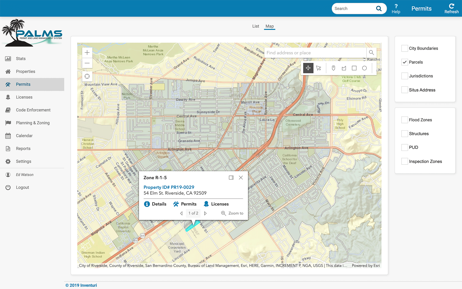
Click on a parcel and a navigation window appears allowing Land Management drill down like never seen before. Easy as a single click
History and all current activities on the property are immediately and available in a single click.
Users can click on Layers for viewing specific features.
Layers are grouped based on the settings in the GIS Web Service.
Other GIS Services such and Google™ and Open Street Maps can be supported.
PALMS GIS Viewer features drawing and selection tools. Drawings are saved automatically based on the record the are associated with. And excellent feature for marking planning and zoning changes on the map.
PALMS GIS Viewer can show routing and directions, and can display field personnel location and sign postings.
Users can toggle or "bounce" between map, card and list while focused on a property, PALMS will retain focus on that property and associated record they are editing or viewing.
Full ESRI GIS Viewer
Elegant Simple ESRI View and Integration
Next Generation Permitting and LMS
27475 Ynez Road #409 · Temecula, CA
V 213 440-5242
V 323 974-3309
© 2019 Inventuri Systems
All Rights Reserved